Archeology on the Floodplain
Archeology at BARC
Maryland Route 200, a state toll road that opened in 2011, connects the cities of Gaithersburg in Montgomery County and Laurel in Prince George’s County. The highway is known locally as the Intercounty Connector or ICC.
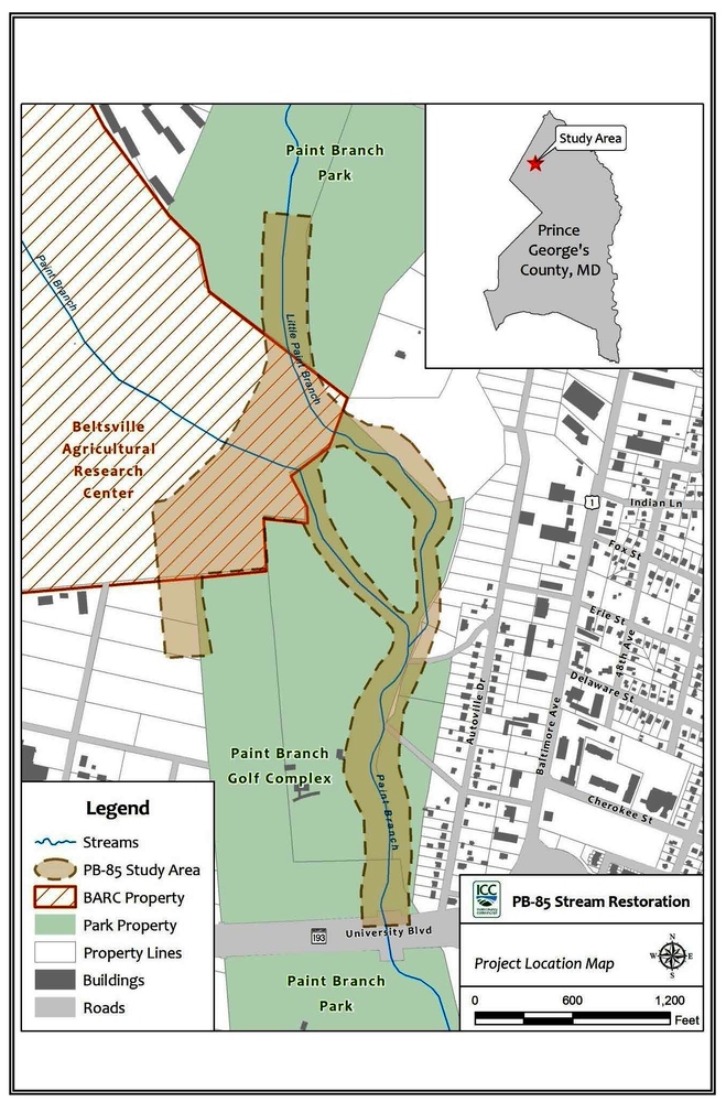
Construction of the highway affected water drainage and wetland habitats in the surrounding area. To reduce the impact of construction on the environment, the Maryland Department of Transportation’s State Highway Administration (SHA) began a project called the PB-85 Stream Restoration and Wetland Creation. The PB-85 project replaced wetlands that were damaged or disturbed by construction of the new highway. The environmental restoration was done along the main stem of Paint Branch Creek, which begins downstream of its confluence with the Little Paint Branch.
SHA made a commitment to identify and evaluate archeological sites and historic structures that might be present in construction areas where reforestation, environmental mitigation, and stewardship sites were planned. So before the restoration began, SHA ordered a survey to determine if the project would disturb any significant archeological resources.
The PB-85 study area included part of the USDA’s Beltsville Agricultural Research Center (BARC) that lay within a floodplain. In the middle of the floodplain, in an area that originally appeared to have been too wet for habitation, archeologists discovered the remains of a small, but very well-preserved Native American site. The archeologists called this section of the study area the BARC Floodplain A Site.
For more information, please see Maryland State Highway Administration's BARC Floodplain A Project Website
 An official website of the United States government.

